
Perfecting Navigation Tools to Enable Autonomous Driving
–
According to telematics experts, high-definition maps are the foundation for all future driving experiences. Knowing exactly where the car is and where it’s heading and having accurate road information is what enables navigation, advanced driving assistance (such as automatic braking), and autonomous cars. Maps even influence insurance costs, fuel economy, and ride-sharing opportunities. So it’s no wonder that the methodology used to create and update maps is now in a dramatic state of flux.
–
Traditional map suppliers such as Google and TomTom still employ technicians driving around in cars festooned with elaborate sensor arrays to digitize every minor and major path accessible to autos. These $ 250,000-and-up tools gather GPS data plus information from radar, lidar, and onboard cameras. Their high-definition vision systems note speed limits, lane markers, and construction detours. Miniaturized versions of these sensors will serve as the eyes of tomorrow’s autonomous vehicles.
–
This wealth of raw data from sensor-equipped vehicles must be scrutinized and analyzed. Before it’s uploaded to cloud storage, it must be compared with known open-source information and vetted for accuracy. Then it’s ready for the mapmakers’ customers—typically carmakers—to download for use in their models equipped with navigation systems. An added service, at extra cost, is access to updates necessitated by major and minor construction projects.
–
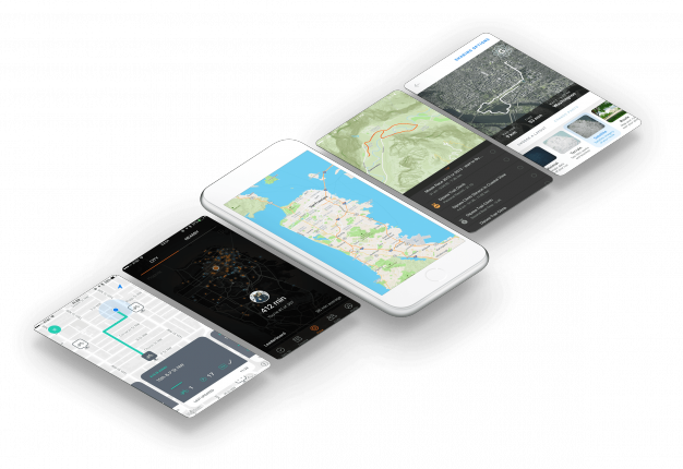
Creating and selling maps with updates is the traditional business model. Mapbox, an innovator founded in 2010 and based in San Francisco and Washington, D.C., has devised an alternative approach. Instead of providing map data, this open-source enterprise sells advanced tools to businesses so they can create their own “living maps.” Mapbox CEO Eric Gundersen explains, “What we offer is a Photoshop for maps, which gives customers the ability to build and update maps best suited to their uses.” In addition to tapping satellite imagery, Mapbox gathers information from vehicles on the road—including precise latitude and longitude, plus a time stamp that allows plotting the centerlines of their paths, directions of travel, speed, and distance from vehicles ahead. To waylay concern about invasion of privacy, this data is anonymized. “We can gather 100 million miles of data per week,” adds Gundersen. “This is used to quickly and accurately update existing maps. So our users can easily provide their navigation customers information that’s practically real time.”
–
–
- –
- High-Definition Maps Plot the Course to Autonomous Cars
- In a Google Future, Drivers May Exchange Data for Infotainment
- INRIX Open Car Wants to Make Infotainment Obsolescence Obsolete
–
–
–
–
–
MapQuest, the Weather Channel, Pinterest, and others are existing Mapbox clients. What Gundersen calls “a major deal with an OEM brand” has been signed. He wouldn’t say who that is, but it’s clear that Google and TomTom have their work cut out keeping up with this new map facilitator.